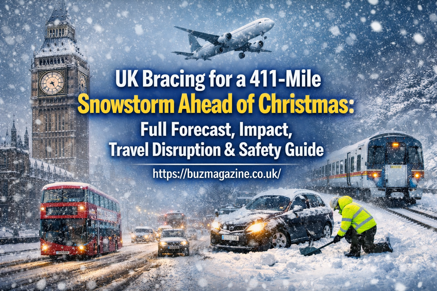
As winter tightens its grip across the United Kingdom, weather experts have issued serious warnings that the country may soon face a massive 411-mile snowstorm ahead of Christmas — a weather event stretching from the far north of Scotland down through England and Wales before reaching the southern coast. Across the UK, forecasts point to plunging temperatures, widespread snowfall, heavy rain, and the potential for significant disruption to travel, daily life, and festive plans.
This comprehensive guide breaks down everything you need to know: what’s coming, how long it could last, which areas are most affected, what to expect on the roads and rails, and how households and communities can prepare safely for a winter storm of this scale.
Why the UK Is Bracing for a 411-Mile Snowstorm Ahead of Christmas
When meteorologists speak of a “411-mile snowstorm,” they refer to the length of the storm system projected to sweep across the UK — from northern Scotland all the way to the southern regions. Such a storm forms when a cold Arctic air mass collides with moist Atlantic winds, creating prolonged snowfall, strong winds, and freezing temperatures across large swathes of the country.
This weather pattern is especially significant this year due to a powerful jet stream and Arctic air incursions pushing cold air southwards. While mild and wet weather has dominated early winter, recent trends show a change that could bring pronounced cold and more wintry conditions as Christmas approaches — though exact snowfall amounts and timing may vary by region.
When Will the Snowstorm Hit and How Long Will It Last?
Timing is critical when preparing for severe weather. The exact onset of the snowstorm depends on how fast cold air interacts with incoming fronts, but forecasts suggest late December into the days leading up to Christmas could see the most active wintry weather.
Snow bands may begin in northern Scotland first, then move southward through northern England and later into central and southern areas. In a prolonged storm like this, different places will experience snow at slightly different times, meaning conditions could persist for several days and possibly linger with below-freezing temperatures that prevent rapid melting.
Experts stress that snow accumulation and cold weather can persist beyond the height of the storm, resulting in icy roads, frosty nights, and cold daytime conditions, even after snowfall lessens.
Weather Maps and Official Warnings Across the UK
The UK’s Met Office and other forecasting agencies issue weather warnings to alert the public about severe conditions. These include:
- Amber warnings for heavy rain and strong winds
- Yellow warnings for snow and ice hazards
- Alerts emphasizing travel disruption risks
At the start of December, the Met Office issued Amber and Yellow warnings across multiple regions, especially the west and northwest of the UK, due to strong winds and heavy rainfall — conditions often preceding colder weather shifts.
Weather maps accompanying these forecasts often display areas of risk with color codes (yellow for caution, amber for significant impacts), helping residents and authorities prepare in advance.
Regions Most Affected by the 411-Mile Snowstorm
Northern England and Scotland
In northern parts of the UK, particularly Scotland, Newcastle, Cumbria, and Northumberland, the storm’s effects are expected to be most significant. Forecasts indicate sustained snowfall, especially across elevated and rural regions, where snow depths could accumulate and affect travel and local transport.
In higher mountainous areas, snow accumulation might be most intense — potentially causing snow drifts and icy stretches along arterial routes and rural roads.
Greater Manchester and Northern Cities
Urban centres like Greater Manchester could see significant snowfall, which — combined with colder temperatures — may disrupt road travel, rail services, and local events.
Southern & Southwestern England
Unlike the north, southwestern regions including Cornwall and Devon are more likely to experience heavy rain and wind, leading to the risk of localised flooding rather than deep snow. In those areas, rainfall accumulations could reach 50–80mm or more in places, especially over elevated ground.
Midlands and Northern Ireland
The Midlands and Northern Ireland are forecast to remain comparatively dry as the storm passes by, but nights will likely be cold with frost and patches of ice forming in rural and suburban locations.
Scotland
Scotland is expected to see some of the lowest temperatures in the UK and the most consistent snow cover, especially at higher elevations — conditions that may persist well after initial snowfall ends.
Storm Bert’s Aftermath: Rain, Flooding, and Saturated Grounds
The potential arrival of a snowstorm follows directly after winter storms like Storm Bert, which left parts of the UK with saturated soils, flooding, and infrastructure stress. When heavy rain follows prior storms, snow and ice on already wet ground can make driving conditions even more treacherous.
Rainfall totals in some areas have been significant this winter, with several regions recording rainfall well above average, adding to the flooding risk when conditions shift.
Temperature Trends, Frost, and Ice Formation
Temperatures during this period are expected to drop significantly. In previous forecasts, Scotland has seen temperatures below 0°C, while England and Wales hover just above freezing — meaning snow can settle and ice can form on roads and pathways.
Once the snow falls and nighttime temperatures remain cold, frost, black ice, and slippery surfaces become major hazards for drivers and pedestrians alike.
Travel Disruption Expected Before Christmas
Road Conditions
Snow and ice on major roads and motorways can slow traffic dramatically. Even a relatively small accumulation of snow can cause dangerous driving conditions, especially overnight.
Rail and Rail Services
Snow between rails, icy tracks, and signal malfunctions due to cold can lead to train delays or cancellations — particularly in the north where snowfall is expected to be heavier.
Airports and Flights
Air travel during winter storms often faces delays due to de-icing procedures and low visibility. Major airports across the UK may see impacts during peak travel periods before Christmas as planes require additional maintenance time to operate safely.
Local Transport and Buses
Local buses and trams can also be affected, especially in suburban and rural areas where snow and ice limit traction and visibility.
Travel advice typically includes checking traffic reports regularly, planning alternatives, and allowing extra time if travel is essential.
Impact on Christmas Plans and Festive Travel
A significant winter storm can affect many aspects of holiday planning:
- Family travel disruptions, especially for those visiting relatives or travelling long distances
- Interruption to public transport schedules
- Supermarket and retail delivery delays
Historically, snowstorms in the UK have sometimes delayed lorries bringing produce and stock to stores, resulting in shortages of fresh milk, bread, and other essentials. Preparing early and shopping ahead of peak periods can reduce the impact of potential delays.
School Closures and Advice for Parents
Severe snow and ice often result in school closures, especially where transport routes become unsafe for school buses. Parents should:
- Monitor local council and school announcements
- Prepare indoor activity plans if schools close
- Ensure children have warm winter clothing
Parents should also encourage children to take care on icy pavements and consider indoor fun alternatives to outdoor play during severe cold spells.
Energy Use, Heating Demand, and Winter Bills
Cold weather drives up energy usage as homes need more heating. During prolonged freezing conditions:
- Heating systems run longer
- Bills may rise due to increased energy consumption
- Older homes with poorer insulation can become especially costly to heat
Simple energy-saving tips include closing curtains at night, sealing drafts, setting thermostats wisely, and wearing layers indoors to keep heating costs manageable during winter storms.
Winter Safety Tips for Homes, Drivers, and Pedestrians
At Home
- Keep heating systems serviced
- Have extra blankets and warm clothing on hand
- Stock essential supplies in case travel becomes dangerous
For Drivers
- Fit winter tyres if possible
- Keep an emergency kit in the car (blankets, food, torch)
- Drive slowly and allow extra stopping distance
For Pedestrians
- Watch for ice on pavements
- Wear sturdy, insulated footwear
- Use handrails where available
What to Include in a Winter Emergency Kit
A winter emergency kit can help families stay safe during power cuts or travel delays. Essentials include:
- Bottled water and non-perishable snacks
- Torch and spare batteries
- Blankets & warm clothing
- First aid supplies & medications
- Charged phone and power bank
If you have pets, include extra food and warm bedding for them as well.
Community Support During Extreme Winter Weather
During severe storms, community support makes a real difference:
- Neighbours checking on elderly residents
- Helping shovel snow from driveways
- Sharing supplies with those who may struggle
Acts of kindness during winter can significantly enhance safety, morale, and resilience.
Is This Snowstorm Linked to Changing Weather Patterns?
While one storm doesn’t establish a climate trend, many scientists note that extreme weather events appear to be increasing in frequency and intensity. Shifts in ocean temperatures, jet stream behavior, and atmospheric circulation can influence winter weather patterns, potentially leading to unusual cold snaps and storm systems.
Climate scientists emphasize that weather remains inherently unpredictable, but long-term trends suggest that variability — including extreme winter storms — could become more common.
FAQs About the UK’s 411-Mile Snowstorm Ahead of Christmas
Will it snow on Christmas Day?
The latest UK forecasts suggest that widespread snow on Christmas Day is unlikely, though a light flurry in parts of the UK can’t be ruled out, especially in higher ground regions.
Which areas will get the worst snow?
Northern Scotland and northern England are expected to see the heaviest snow accumulations, while southern regions may experience rain or sleet.
Will schools close due to the snow?
Some schools may close depending on conditions and local council decisions — especially in areas with heavy snow or unsafe travel conditions.
Should I travel during the storm?
Travel should be limited to essential needs during the peak of the storm. Always check local transport updates and weather warnings before leaving home.
Will there be power cuts?
While not guaranteed, severe snow and wind can lead to localized power outages. Having a prepared emergency kit offers peace of mind.
Conclusion — Staying Safe, Prepared, and Informed This Winter
The UK facing a 411-mile snowstorm ahead of Christmas is a scenario that brings both wonder and challenge. Snow can transform landscapes into picturesque scenes, but it also carries risks: dangerous travel conditions, flooding, frozen pipes, and disruption to daily routines.
By staying informed with trusted weather updates, preparing your home, and prioritizing safety over convenience, you can navigate this winter weather with confidence. With careful planning, clear community cooperation, and respect for the power of nature, families across the UK can stay warm, connected, and prepared — even in the face of one of the season’s most formidable storms.
ALSO READ: Kilkee Benches Replaced with Plastic: Heritage, Sustainability, and Community Reaction Explained